
Camden’s initiative in drafting this Framework is to be welcomed. However we feel it has some fundamental flaws arising in part out of a series of untested assumptions and a lack of reference to the reasons for successful urban regeneration in the surrounding urban villages of ‘Little Bloomsbury’, Seven Dials, Covent Garden and Soho over the last 25 years.
Key documents (and their outcomes, methodologies etc) are not referred to, for example – the ‘Covent Garden Action Area Plan’, The ‘Seven Environmental Dials Study’, Westminster’s ‘West End Entertainment Impact Study, and the reasons for their declaration of ‘Stress Areas’, the CAG Report and the current NRF Consultancy.
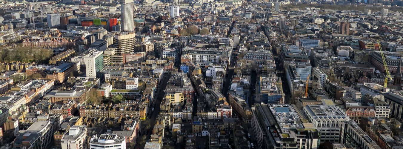
The framework paper lacks a simple clear map at the outset showing the current streets and showing the development of the area over the years. We attach a map of the St Giles Parish from 1723 (7 Dials Charity ‘Seven Dials’ 1988). A series of such maps plus information from the Denmark Street Conservation Area Statement (DSCAS) would assist in understanding the changes which have occurred, especially the impact of the Victorian road widening schemes, and the post WW2 demolitions and changes. Understanding past changes, and indeed errors, can assist in the current analysis and indeed in clarifying the outcomes sought.
Similarly there is a lack of basic tabulated information on both residential and its location and on the numbers, and nature of the existing mixed commercial uses in the area. Sweeping generalizations are no substitute for a rigorous analysis based upon hard facts. For example it would be easy to set out the existing social facilities – Dragon Hall, the Oasis, the new community centre in Earlham Street, the schools (and whether they are over-capacity), the open spaces etc.
The paper is based upon some fundamental assumptions, which are not tested via any form of cost | benefit analysis:
It is assumed that the area needs to be ‘opened up’ and that this would be a good thing;
It is assumed that increasing the pedestrian flows would be a good thing;
It is assumed that opening up routes or ‘desire lines’ as between the urban villages would only have positive benefits;
It is assumed that high rise buildings would make a positive contribution;
It is assumed that certain key buildings should be re-developed contradicting the DSCAS (notably the mansion blocks in Charring Cross Road and St. Giles High Street);
It is assumed that in Denmark Street the existing unique mix of uses can be protected whilst at the same time ‘modernising’ the street;
It is assumed that key transport capacities will be increased whilst at the same time recognising that such increase in capacities should be a pre-requisite of some of the proposed developments.
Most interestingly the first sentence in the ‘Covent Garden Action Plan’ (and the basic reason which the then GLC sought CDA powers) was ‘to resist the inevitable pressures that will arise on the removal of the CG Market’. This framework, on the other hand, is underpinned by an unstated acceptance of such pressures and seems designed to facilitate them, possibly on the also unstated assumption that they will pay for environmental and social benefits.
001 Limits on Intensification
Any policy with an identified boundary inevitably creates additional pressure immediately outside the boundary. It is therefore imperative that a policy is spelt out which makes clear that outside the identified AFI no increase in existing densities is acceptable. The boundary of the Area for Intimidation requires significant amendment as shown on the plan included in the report.
002 Transport Capacity and Congestion
Both Camden’s UDP and the London Plan recognize the need to relate business expansion to the programme for increased transport capacity. There is currently no spare transport capacity of TCR nor have any increases in the capacity been programmed within the 10 year life of the Plans. The proposed new Ticket Hall at Tottenham Ct Rd station will increase station capacity but clearly will not increase train capacity. Against this background no increases in commercial floor space particularly offices is acceptable since it would not be matched by commensurate increases in transport capacity. This is consistent with Camden’s UDP policies and the Mayor’s Plan.
003 Services and Amenity
Intensification and development will inevitably increase pressure on the existing inadequate facilities particularly open space and leisure. The nearest open spaces St Giles, Soho Square and Crabtree Field are already insufficient for existing demand. The required additional POS, play space and leisure facilities need to be quantified and provided as part of any intensification. Similarly the welcome increase in housing may (depending upon a proper analysis) need to be matched by the necessary increase in education, primary healthcare and community facilities.
004 Analysis
A more detailed analysis is needed of the existing area to include identification of existing residential user numbers, age, size and tenure of dwellings as well as existing businesses by size and nature of employment mix.
005 Site Development Briefs
Detailed comments and fuller conclusions are in the accompanying response. All the schedules of ‘demands’ as part of any section 106 agreement require to be substantially revised.
i) St Giles Court.
The objective of achieving a genuine mixed use development is supported. Given the already large amount of office floor space and the constraints of transport capacity any increase in foolscap should be for other than B1 uses. Retail, small specialist units at ground level and residential 50% affordable residential with supporting facilities. The proposal to encourage A3 use is not supported.
ii) 21-31 New Oxford Street (former Post Office).
This should be earmarked for residential use including minimum 50% affordable with some retail uses at street level. The existing building lends itself to rehabilitation and conversion into residential accommodation. There should be a significant element of educational use in the development and no A3 nor hotel use.
iii) Denmark Place.
This block should be left well alone – it is certainly unsuitable for any intensification. There is currently a very delicate balance which allows the specialist music business to survive. The existing residential property along St Giles High Street should be rehabilitated and Camden should use their CPO powers accordingly.
iv) 263-267 Tottenham Ct Road
There is absolutely no logic or justification for including this leg north of New Oxford Street. The recent planning application was dismissed on Appeal and did not involve any significant intensification, in built forms terms it reflected adjoining buildings. It should be excluded from AFI.
The paragraphs below are seriatim to the Framework Sections.
Introduction (pages 1-3)
001 At the outset the report should make clear the likely consequences of permitting more intensive commercial and residential development in relation to the existing public facilities such as open space, community and leisure facilities so as to establish whether they are adequate. In addition the report should highlight the need to make provision for the necessary educational, play and primary health care facilities to match the increased housing targets. The suggestion that the above will be adequately provided by way of Section 106 agreement needs to be tested, and this cannot be done without a proper analysis.
002 Camden’s UDP, the Mayor’s Plan and the proposed planning framework for Tottenham Court Road are relevant for a maximum of ten years.
003 We cannot see any evidence pointing to either Cross Rail 1 or Cross Rail 2 being realised within the next ten year period, and thus to promulgate planning policies on the assumption that there will be a substantive increase in capacity in the underground network is not only contrary to Camden’s UDP policies but must appear an untenable assumption.
004 Consequently any proposals within the defined “Area of Intensification” must be promulgated on the basis that either the proposals will place no further capacity pressure on the current public transport facilities at Tottenham Court Road or be treated as premature until the transport capacity, particularly to the Underground has been substantially increased. The proposed new ticket hall for Tottenham Court Road underground station is obviously welcome, and will increase the station capacity but not train capacity and this has to be radically improved before any “intensification” occurs. This should be a tenet of the planning framework and be stated explicitly within the introductory section of the report.
005 The various development proposals for 263-267 Tottenham Court Road should not be considered as a justification for the Council to promote development to a higher density. This particular small site is within a conservation area and abuts a listed building, and is already very densely developed. To suggest as the report does that the site could be developed “more intensively” implying a building of a greater scale and mass must appear to undermine the conservation and urban design policies in the UDP. The recent application was dismissed on appeal despite not involving intensification, so its inclusion as intrinsic to the “A&I” appears to lack logic or justification.
006 The Council should specify what they consider would be an acceptable level of intensification. Similarly there have been many development proposals for the Andrew Borde Street/ Denmark Street block over the past decade. The fact that the majority of Denmark Street is listed and the site is entirely within a Conservation Area, again physically militates against any intensification of development. Bearing in mind the unique mix of uses and the desire to protect the specialist music related traders, the proposal to designate this block within the proposed “Area of Intensification” could not be more short sighted and destructive. There is no mention of para’s, 6.3, 7.9, and 10.15 in the DSCAS all of which indicate a presumption in favour of retention of the mansions blocks.
007 The Draft London Plan does identify possible areas for intensification but the Inspector’s report clearly states how potential development should address Central London residential communities.
008 In his report the Inspector sets out a strategic policy f or the Central Area and within potential AfI’s which should be to “ maximise the number of additional homes including affordable housing in the CAZ and enhance local residential environments and services to ensure mixed and balanced communities.” (See para A19)
009 If an “Area of Intensification” is to be defined and within which higher density development to higher plot ratios is considered permissible, then the corollary is also as important, in that the area not within the “Area of Intensification” should have policies that ensure higher density development does not creep out of the AfI and into the adjacent neighborhoods. Intensification of an area for development inevitably increases pressure on boundary areas and leads to the necessity for specific policies as per para 011 below.
010 No mention of this is made within the report and we fear that due to the debatable strength of the UDP land use policies that apply to any development within the Central Activity Zone, once the “Area of Intensification” is defined it’s existence will de facto give rise to yet greater development pressure on a much larger area.
011 Consequently the Introductory section of the report should set out a clear policy statement that outside the “AfI” planning policies will have a presumption against development that increases existing plot ratios and thus will not lead to higher density development as a spin of from the “Afl”. Currently as drafted there is an assumption that once the “AfI” is established considerably more redevelopment schemes in addition to the sites identified, will “emerge” (see paragraph 1.5). It is precisely because of the Domino effect of the “AfI ” that stringent policies must be in place at the outset, which will apply to the area immediately surrounding the “AfI”.
- 12.The suggestion that the Draft Area Supplementary Planning Guidance (SPG) protects specialist Central London businesses and will ensure the central London neighbourhoods will not be an overrun by an over concentration of food and drink establishment (A3 Uses) must appear somewhat naive. The draft report encourages more A3 uses and within Covent Garden and large swathes of Fitzrovia and Bloomsbury. The Council suggests that up to 20% street frontages of designated street can be changed into restaurants/bars/night time venues. Experience within Camden Town and Soho and other areas indicates that the foregoing is likely to lead to substantial dis-benefits which are not tabulated here.
Indeed the proposal is somewhat crude even in its own terms – it does not, for example, propose making use of the imminent changes in the Use Class Orders so as to finesse the sorts of uses proposed. It makes no mention of the analysis in Camden’s own ‘Crime & Disorder Strategy 2002-2005’ where there are clear statistics demonstrating the correlation between crime and disorder and the numbers of licensed premises.
13 The gulf between what the report claims and actuality is demonstrated by the suggestion that the Council’s Clear Zone Policy is “actively ‘reprioritising’ (sic) road space away from private vehicles”.
14 The Clear Zone incorporates most of Fitzrovia, part of Bloomsbury and the whole of Covent Garden. It has existed for over five years and may have received as much as £1.5m of special Government funding. Many reports have been written but the only action has occurred within the Clear Zone Area as far as we know is to partially pedestrianise Museum Street and close Malet Street to southbound traffic. During this period absolutely no other environmental improvements have been undertaken within the Clear Zone. What is worse during the same period the Council has granted many planning approvals that substantially increase traffic movement and intensify road use by private vehicles within the Clear Zone for example the Hospital Venue in Endell Street, The Kingsway Hotel in Great Queen Street and the British Transport Police Station in Whitfield Street. We propose that the Framework sets out in simple spreadsheet form ways of improving joined-up working so as to better realise these aims.
- 15.Clearly the Planning Framework document needs reflect reality. Before a major shift in planning policy is made that will encourage higher density commercial development in the Tottenham Court Road area that straddles severely stressed local residential communities (Soho, Covent Garden, Fitzrovia; Bloomsbury and Hanway Place & Hanway Street) a rigorous critical analysis must be undertaken to understand what is the current situation and the effect of current and proposed planning policies. The report not only fails to contain any substantive analytical analysis of uses, existing densities, ownership patterns and how to protect and enhance what is considered most important, but it appears to distort current planning policies and their results.
16 The report also fails to include relevant policies and studies undertaken by Westminster City Council. It fails to mention that both Covent Garden, Soho and part of Fitzrovia are designated “Stress Areas” by Westminster, and within these two neighbourhoods the presumption is that no new A3 uses (current land use definition) will be permitted. Moreover Westminster have a more stringent appreciation of the environmental erosion of the areas as a consequence of noisy and disruptive activities. Westminster also has very strict planning policies that apply to all new applications for air conditioning and additional plant for commercial premises. Paragraph 1.7 suggests there is a complication as the Tottenham Court Road area lies between Camden & Westminster. To suggest the boundary is a “complication” can only be because Westminster might have very different policies. Again no analysis is made as to which policies are different, the reasons why, and how thus this might affect Camden’s plans.
17 It is odd that the “other studies” listed in paragraph 1.10 does not include local initiatives such as the ‘7 Dials Renaissance Study’ or indeed relevant Westminster Studies, nor the plethora of evidence given by the various community groups over the years with regard to various UDP enquiries. This research would throw up very different conclusions to what has been those in the current planning framework section of the report
- 18.Paragraph 1.4 suggests that the report “explores new ground in terms of purpose and scope” and goes on to say “that it is difficult to forecast what change will occur”. This new ground is not apparent to us. The fact that the document accepts that it cannot forecast what might occur is a peculiar admission. On one hand the report appears to suggest a laissez faire attitude to development where current density standards will largely be scrapped and “higher density development” will be “encouraged” and then the report suggests it does not know what the consequence will be or what “forces of change” will occur. It occurs to us that it is very obvious that if greater commercial development is to be permitted then greater development pressure will occur, with greater pedestrian and vehicular congestion and greater conflict with existing “pressurised” uses and activities like the specialist music shops in Denmark Street. This approach is quite different to that of the successful ‘CG Action Area Plan.’
019 The reports appears to lack a coherent structure. Logically it should first set out what is the current situation, what are the Council’s priorities, what current policies support these priorities, which do not, and what pressures exist that run contrary to the Council’s priorities and those that are supportive. Once this analysis is done it will be possible to set out a clear set of criteria and planning objectives can be identified, clear strategies set out as to how these objectives will be met and be monitored.
020 What the report states, see Page 3, under the title “Structure of the Report” is that the Council have no clear objectives but merely hope to achieve some improvements as a by product of commercial development. There is no mention of what are the primary land uses Council requires, no mention of the effect of any policies on the immediate locality, no mention of criteria by which any development can be judged a success or a failure. As drafted the structure of the report inevitably produces a set of vague aspirations and may well be used by the development market to justify over development under the guise of “intensification” and “higher density”.
DESCRIPTION OF THE AREA
022 We question the arbitrary boundary proposed for the AfI and its size. Attached is a plan that describes what we consider should be the maximum size of the “Area of Intensification” and also a further area which explicitly is not included within the “A&I” and where stringent planning policies will apply theatre based on the presumption that increasing plot ratios will not be permitted (see para 011 above).
023 In the attached the following areas have been excluded from the A&I:
A The north east block bounded by Tottenham Court Road, New Oxford St and Great Russell Street (The Dominion and Horseshoe Hotel site)
024 This should be excluded as the majority of the site contains listed buildings and contains a theatre, which has additional planning protection that will ensure this land use will remain. The fact that a small corner of the block has been subject to various applications (which have been turned down on appeal) is no reason to incorporate the whole block within the proposed “A&I”. Indeed the opposite is the case.
B The south block bounded by Andrew Borde Street, Charing X Road, Denmark Street
025 The development of this site should be predicated on renovation and repair, not least because the block contains many listed buildings and is within a conservation area, but because the overwhelming majority of the buildings are in sound condition and are occupied by a huge variety of activities and specialist firms that need to be protected and retained. To designate the site within the “A&I” will put yet more commercial pressure of the very activities the Council seeks to protect. The tenure and type of residential accommodation in the Victorian residential blocks (Sheldon Mansions, Clifton & York Mansions) will inevitably be altered to exclude “affordable housing” and the threat of development implied by the “A&I” designation will put further pressure on the specialist music retail businesses, and on the existing retail frontages which exist beneath all these blocks (there seems to be an assumption that they don’t in St Giles High Street or that they are inadequate).
026 The specialist music businesses operate and survive in Denmark precisely because of the condition and type of the buildings they occupy. It is also important to recognise that the concentration on both sides of Denmark Street gives a level of intensity that ensures the music trade remains. Once one side of Denmark Street is developed the remaining music shops on the other side are likely to suffer the same fate as Berwick Street market, or the specialist shops in Old Compton Street.
027 The inclusion of this block within the “A&I” is likely to destroy precisely what the paper purports to protect, and there are exemplars throughout the West End demonstrating this.. The Council should be pursuing policies that explicitly seek to retain the block much as it currently is, and to encourage development only of those parts that are requiring renewal like the frontage site on the corner of Andrew Borde Street and Charing X Road.
028 This site should be excluded from the “AfI”. Much of the material within the DSCAS leads to this conclusion.
C Everything east of Castlewood House in New Oxford Street and Dyott Street
029 The urban morphology and built form of the section east of Dyott Street is predominantly a series of Victorian developments, largely residential or institutional including some major important land uses like the Shaftesbury Theatre. These blocks came about as a consequence of the road improvements undertaken by Metropolitan Board of Works and later the LCC that resulted in the construction of Shaftesbury Avenue and New Oxford Street.
030 The only block that offers the potential of development east of Dyott Street is the old West End Central GPO sorting office but as the building is already constructed to a very high density there should be no further intensification. The fact that it has been subject to various development proposals is not justification for including the site within the “A&I”. As it has no established land use is it should be excluded from the “A&I” as otherwise it will be subject to inflated commercial expectations. As no established use exists the Council should draw up a detailed planning brief that is based on the Council’s stated highest land use priority, namely housing. The size and construction of the building suggests that any new use for the site could be based on retaining the existing building.
031 The majority of all the properties east of Dyott Street are small scale and in multiplicity of uses and ownership and contain a high concentration of residential accommodation. Many are listed. To lump these properties within the proposed “A&I” will only result in additional commercial pressure being applied to buildings that currently enjoy a mix of activities that assist in giving some relief to the homogenous high rent retail/commercial activities prevalent in Oxford Street and the first section of New Oxford Street.
032 It is pertinent to note that probably the worst building within this section of the proposed AfI that should be redeveloped is Selkirk House, 166 High Holborn. Yet the report makes no mention of this building and it is not highlighted as a potential development. In the context of the Clear Zone and protestations that the Council wishes to ‘reprioritize’ the streets for pedestrian use it is odd that there are no suggestions on changing the use of the huge underground car park. Even if the building is retained the car park could provide secure cycle parking with associated shower provision, or become the servicing hub for the neighbouring streets or even a major recycling centre. No proposals are made in the report. A development or reuse of this building should be a very high priority indeed if the Council were serious about endeavouring to improve the physical environment, and influencing the balance between uses on the street.
033 The bald statement in para 2.4 that merely because a building is within the proposed “A&I” does not imply any particular building is a candidate for redevelopment might appear naive. The fact that the building is listed gives some protection to the physical protection of a building but little with regard to use and activity. The fact that a building is within the proposed “A&I” will immediately put further commercial pressure on the activity that takes place within building as owners will seek to “maximise” and “exploit” the commercial potential by way of “improving” the buildings and “rationalising” the layouts all justified by the Council’s desire to intensify development within the designated area.
034 The whole block east of Dyott Street should be designated an “Area not suitable for intense development” and no development should take place that will increase or unify the current plots. There should be detailed planning briefs prepared for the Selkirk House that seeks to eliminate the underground car park and demolish the existing office and housing block above. In addition the planning brief for the ex GPO sorting office should state unequivocally that any development of the building must be predominantly for residential use – 90% of the floor area with additional supporting facilities (like amenity space) and the presumption should be for a conversion of the sorting office existing building not redevelopment.
035 In summary the only area that we consider should be designated an “Area for Intensification” is the block bounded by Charing X Road, New Oxford St, and through to Bucknall Street after Castlewood House, and then to Dyott Street, St Giles High St and Andrew Borde St, including Centre Point, St Giles Court and Castlewood House fronting
New Oxford St.
Area Characteristics
036 This section of the report fails to give any details of the existing types of accommodation, sizes, uses and relative floor areas and thus fails to substantiate the Council’s land use proposals. For example how many “properties are vacant and boarded up” (para 2.8) ? Who owns the buildings, and what planning use do they have? In the context of the short “10 year life” of the report, some “vacant properties” could benefit from short term use and if it is considered desirable particular planning policies could be applied to ensure this occurs. Alternatively if the buildings have been vacant and derelict for many years they may be suitable for Compulsory Purchase.
037 The fact that a building has not been modernised (see para 2.8) is not necessarily a bad thing. What is important is that the fabric of the building is sound. Interesting uses, like the music traders in Denmark Street probably only remain because their buildings are not “modernised”, and obviously, to many the less modernisation that has occurred to a listed building the better. The way the report is currently written implies throughout that if a building is not modernised this is sufficient justification for development, when in fact it may be quite the opposite, as is in Denmark Street.
038 The suggestion that the street blocks and roads should have a rhythm and regularity (see para 2.9) misinterprets the quality and nature of the street pattern and how it has evolved (see comments above re historical maps). It is precisely because the ‘set pieces’ of the landed estates are submerged into the medieval street pattern that this part of Camden has a variety of street sizes and different sized street blocks. The Victorian interventions merely widened existing roads and led to the construction of residential mansion blocks and new theatres
039 It has been the 20c interventions inspired and influenced by planners, (Centrepoint, Selkirk House Drury Lane) that have disrupted the street network and visual coherence . The suggest an “Area of Intensification” will rectify the problems of traffic around Centrepoint and the visual damage of these late 20c developments is set out as an assertion. Rather it is much more likely to worsen the existing congested and further dislocate the visual quality of the area.
040 Full details of where residents reside within the area are required. Paragraph 2.10 is woefully inadequate. The Denmark St block is a densely residential block, as is the Shaftesbury Avenue/Grape Street area. To be meaningful an accurate residential survey is required that:
1 Identifies where existing residential use exists.
2 What is vacant.
3 What number of dwellings exist and their size.
4 Types of tenure.
5 Analysis of resident (age etc).
041 From this information it will be practical to make reasoned argument why particular policies should apply and why the planning briefs contain particular objectives.
042 Similarly the bland statement that 10,000 people work in the proposed AfI and are “covered by this framework” (para 2.11) is not very enlightening. What framework? What would be of interest is the size of businesses people work for, the mix of businesses and their relative age. Again this will guide the kind of relevant commercial space that should be maintained or provided to ensure a good mix of employment. In addition there is no analysis of the existing local services and community facilities and what their capacity. This is vital if it is suggested that the working and residential populationist are to be substantially increased.
043 The lack of factual research and analysis results in extreme vagueness throughout the planning framework and detailed planning briefs so that they are likely to be interpreted in many conflicting ways.
044 Paragraph 2.13 suggests that the area is somehow distinct from those neighbourhoods around the Tottenham Court Road/Oxford Street junction. This is clearly not the case as the proposed “A&I” contains many activities that are common to neighbouring streets . There are some special activities (like Denmark Street – Tin Pan Alley but this is the exception. The idea that the neighbourhoods have to somehow always merge (or submerge) and be permeable with others will, in areas of high land value, merely produce a boring homogenous environment whereas any planning framework should set out to encourage a heterogeneous neighbourhood.
045 This would be best achieved by deliberately not pursuing a built environment that is highly permeable. The reason why The British Museum area has a different feel to the north of Covent Garden is in part because of the physical barrier of New Oxford Street and this is desirable.
046 The fact that few retail businesses exist is not in itself a bad thing. Indeed those that do are generally of a specialist nature and are ‘destination’ stores. Their lack of a primary retail street frontage implies lower rents which allows interesting retail uses to operate in this part of the west end.
047 The suggestion that retail traders “appear to struggle to attract custom” is stated with no evidence whatsoever. Many retail businesses survive in the area precisely because they are not located in high profile primary retail locations. The Framework clearly regards this as a very bad thing. Once the area is opened up, they will disappear as surely as have almost all the other specialist shops throughout the West End (the exceptions being mostly those on very long leases or owning their own freeholds).
048 Map 2 requires to be amended. The area indicated “university” is in fact Fitzrovia. The university precinct is in fact east of Gower Street and north of the British Museum.
049 The argument for the need for additional linkage is not made.
050 The most effective way to improve the street environment (para 2.15) would be for the Council to undertake some simple street improvements. This does not require major plans in “Areas of Intensification”, just commitment to make street improvements, which despite the Clear Zone designation, has to date been singularly lacking. The reduction of vehicular accidents does not require the designation of “A&I”. What is required is for a simple low keyed approach to implement traffic calming schemes, widening pavements and providing safe pedestrian crossing points. The reason why St Giles Circus has a high proportion of pedestrian accidents is because of the acute lack of pedestrian space relative to the number of people using the area. This situation will get much worse if the Council encourage more activities and developments to higher density.
051 The reason why crime and antisocial behaviour is so evident in this area is primarily because it is one of the major areas of drug dealing and because extremely high concentration of hostels where recently 85% of residents are ‘chaotic’ drug users. The physical environment is of secondary importance. The location of a “temporary” needle exchange ( so temporary it has been in existence now for almost five years) without any backup facilities and very high level of short term accommodation in the immediate vicinity to the middle exchange all contributes to the high level of crime. In addition the relative ease of getting money by begging due the central location in the West End, are further reasons for the high level of drug dealing on the streets.
052 The report makes no mention of these considerations.
053 To increase the level of street surveillance will not solve these problems. Indeed large sections are already surveyed by remote CCTV . The Council deludes itself if it considers that the situation can be substantially improved by physical alterations.
054 Camden’s Aims – A vision for the future
The primary aim should be in accordance with the Council’s UDP and the Mayor’s Draft Plan, namely to provide more residential accommodation and specifically more affordable housing. This should be the single most important objective and if implemented could radically improve the locality.
055 The expansion of the general office employment facilities (see para 3.6) should be of a very low priority. The protection and enhancement of specialist employment is a rational policy as it will ensure a continued mix in the area. To encourage more employment (implying primarily through more office development) will increase congestion, and runs counter to the principle of sustainability as such a growth will merely increase traffic/transport movements.
056 If the primary concern is to increase the residential population coupled to a programme of environmental improvements the area and its immediate neighbours will be improved both physically and socially. In addition and in accordance with the Inspector’s Report with the Mayors Plan the priority should be to “Ensure the provision of the appropriate range of social and community facilities” within the central area and the “A&I” (see policy 3A.16 of the Mayors Plan as recommended to be amended by the Inspector paragraph A25).
057 The concept of improving the physical environment as set out in para 3.4 does not require the delineation of the area as “A&I”. Indeed proposals centred around St Giles-in-the-Field will be outside the Council’s boundary for the “Area of Intensity”.
058 Map 3 (network of Pedestrian Routes) is particularly confusing, and unreadable. A significant improvement could be affected immediately by the Council maintaining what little open space it already owns better, in particular St Giles-in-the-Fields courtyard. The idea that these improvements need to wait on the designation of the “A&I” appears illogical. Improvements could be and should be instigated now.
059 Paragraph 3.8lacks logic. There is no spare capacity in the local public transport facilities. The present situation is one of extreme overcrowding. The idea that higher and more intensive development in this situation is acceptable clearly cannot follow, and the suggestion that mixed use developments which implicitly imply more commercial development is the only sustainable approach in the present context is again an assertion only.
060 Clearly some commercial/retail use would be practical within a residential development as well as provision of social facilities and open space where a proper analysis demonstrates the need, but the current UDP policies concerning mix use makes it clear that within the “A&I” the primary use would not be residential but offices, retail and entertainment uses all of which will worsen the existing private and public transport congestion.
061 Paragraph 3.9 is welcome but is not reflected in the planning briefs.
062 The analysis contained in para 3 as to why the area around Centrepoint has “remained unfinished” appears rather simplistic. The failure of the Council to take any direct intervention might be argued a major contributory factor and the Council’s reliance on the development market generating any improvement may well result in a repeat of the failure of the last planning exercise in the 1960’s that resulted in the development around St Giles High St and Centre Point.
063 All “stake holders” listed in Box 1 except the residents community groups and local businesses have their own fully paid professional teams. If the Council were serious about consulting each stake holder on an equal basis or at least in a balanced manner, then the residential/community/local business groups should be adequately resourced.
064 Until this is done the Council will inevitably be unduly influenced by the other parties. It is very significant that developers feel sufficiently confident to prepare and display planning applications before a development brief is agreed.
Section 4 – Land Use Objectives.
065 Paragraphs 4.2 & 4.3 should be revised on the basis of the more rigorous research we recommend, including scheduling a list of uses and their minimum required areas. The only potential development site within our proposed “A&I” is the St Giles Court site, and a simple urban design study could determine the likely quantum of residential floors pace that can be fitted on the site and also the required quantity of affordable accommodation.
066 Paragraph 4.4 suggests higher densities will be required to get better mix of development. This bald statement has no justification, but it will be used to justify larger and denser development. The use/s to which land is put will have a pivotal affect on the likely level of intensity not visa versa.
067 The failure to mention affordable housing in paragraph 4.7 is symptomatic of the general ‘market lead’ approach contained within the planning framework report. The report should contain a clear and prescriptive schedule of the expected quantity of residential accommodation and affordable accommodation.
- 68.Where the Council’s report is prescriptive is demanding over 50% of all new accommodation being ‘family sized’. While we do not object to this ambition it is evident that no thought has been made on tits effect on local social facilities. Can the local schools accommodate more children? Can the Oasis Swimming Pool cater for more families ? Is there sufficient open space? What social facilities are required to cater for this increase in residential population? There are no answers to any of these questions in the report and the proposals are not grounded on any substantive analysis.
069 The suggestion in paragraph 4.11 that new employment will be the local community is farcical. How will this be monitored? What kind of employment is to be provided? What are the local requirements? In addition the objectives of the Covent Garden NRA will be adversely affected by the current wording and emphasis on more commercial development in the northern part of the NRA neighbourhood.
070 It is difficult to understand what paragraph 4.11 has to do with controlling development and land use policies.
071 We would support paragraph 4.12 if it would make it clear what the Council is proposing. Again what community uses are required, or will be required, of what size and how are these requirements going to be provided and funded, again arising out of (in this case simple) analysis of what exists.?
072 Previous mention has been made of the failure of the Council to undertaking any street improvements (4.15). The best way the Council could improve the local amenity space is to improve those areas the Council owns and controls namely the streets. An action programme of street improvements could be put into affect very quickly if the Council were so minded.
073 The section dealing with Food & Drink& Leisure (para 4.18) is highly contentious and we question many of the proposals in the draft SPG especially the proposal to allow up to 20% of designated street frontages to contain A3 uses. This implies that the most of the area is ‘ripe’ for additional A3 development irrespective of the lack of servicing, existing congestion and the consequential erosion of existing residential amenities (or indeed any definition of what sort A3).
074 Similarly the suggestion in paragraph 4.17 that more tourist related activity would be appropriate is debatable since there is not cost benefit analysis only a series of uncritical assumptions (benefits). The failure to assess the effects of the growth of tourist related activities has, in the view of some, resulted in a very significant diminution in the environmental quality for residents as well as for local businesses. Noise, disruption, congestion and local activities being “priced out” of the neighbourhoods are all evidence of the detrimental affects of additional tourism. Interestingly in the ‘CG Action Plan’, an entertainment route was devised so as to minimise dis-benefits and maximise benefits. No such sophistication is evident here.
075 Map 4 is so bland as to be almost meaningless; it is also inaccurate in that it fails to include the fact that there are large sections covered by the map where not only at street level but also on floors above the predominant use is residential. We strongly object to the suggestion that the Central London retail frontage is extended as proposed as to do so will merely increase the commercial pressure along these streets/wash. The last sentence of para 4.18 is not substantiated. We consider the amenity for residents will be worsened and the greater activity at ground level will cause more conflict and less permeable. Be that as it may there no evidence is put forward to substantiate such a contentious claim. To suggest that north of New Oxford St is primarily cultural use ignores the densely residential nature of Little Bloomsbury.
- 76.We object to all the notes in Boxes 2-6 not least because we reject the proposed boundary of the “Area of Intensification” (implying that boxes 2, 3, 5 & 6 are irrelevant) but because of the content where the priority land uses are not spelt out and because they encourage development rather than leaving well alone (for example Denmark Place block).
Section 5 – Transport Circulation Objectives.
- 77.The section dealing with Transport (no. 5) paras 5.1-5.6 is full of contradictions. On one hand the report states that there is the need to provide a good public transport system is to be encouraged but the existence of a defacto bus station around Centrepoint is deplored. The current ‘bus station’ is an eyesore but apart from hand wringing the Council’s report come up with no proposals of how to improve the current situation. Surely the need for improvement for buses should be a priority objective. All the comments concerning the underground improvements presuppose their implementation within the next 10 years yet the Council knows this is not the case. To promote planning policies whose foundations do not exist is questionable.
078 All the pedestrian route set out crudely in Map 5 already exists. What the Council should do is to carry out environmental and street improvements and these should be set out clearly on a series of plans cross referred to dates of completion. Such proposals have lain on the table for many years in both the ‘St Giles & Seven Dials’ studies.
079 The Transport For London (TfL) through its Clear Zone policy has given Camden sizeable sums to make these improvements. To our knowledge all the money has been spent to very little effect. The report should list what improvements will be undertaken and by when for otherwise with regard to this aspect of the proposals, this aspect of the report will join the long list of Council aspirations, and consultancies, which have resulted in no action.
080 We have no objection to the cycle routes but do not see why their implementation can not proceed forthwith. However often in the narrow streets of the central area traffic management and the reduction through traffic is more effective than dedicated cycle routes.
081 Paragraphs 5.21-5.23 concerning vehicular services makes no mention of plant and other ‘servicing’ of commercial space. The level of noise and proliferation of air conditioning plant without any effective Council control is of major concern.
- 82.Major new developments along the existing Central London retail frontages have always been to the rear of the main streets causing major congestion and erosion to the amenity of the quieter back roads/streets. The effect has been to increase servicing problems by spreading the areas affected into the quieter generally more mixed area behind the main retail frontages. This should be discouraged and all servicing should be made from the main retail frontages not from the rear.
Section 6 – Heritage
083 The section dealing with Heritage & the Public realm is largely a regurgitation of previously published reports. It fails to relate the architectural quality and visual amenity to the uses that occur in the buildings being described. Conservation is not just about the physical fabric but about activities and the use to which buildings are put. Nowhere in the section is there any proposal of how important activities that contribute to the public realm and heritage are to be protected and enhanced. Judicious public ownership is one method or covenanted land and legal conditions attached to approvals is another.
084 The Box 8 that deals with Conservation Areas fails to include the conservation area that includes Hanway Place and Hanway Street west of the proposed A&I. Kt fails to mention key aspects of the DSCAS which contradict aspects of the proposals set out in the framework paper (notably in relation to the mansion blocks).
085 The section dealing with scale (paras 6.16-6.18) making the unsupported statement that additional taller buildings on a par to Centrepoint would be appropriate. No mention is made of shadow or environmental adverse effects is mentioned and no mention made of the adverse effect of having further tall buildings that will erode the quality of the conservation area. The simplistic idea that tall buildings “improve legibility” is banal. No evidence whatsoever is given to support the apparent acquiescence, indeed encouragement for more tall buildings close to Centrepoint.
Next Steps
086 The report should be reconsidered on the basis of a more logical approach based upon better research; the Afl substantially reduced, and detailed analytical study of existing land uses undertaken. The local groups should be financially empowered by the Council to prepare their own considered proposals making use where necessary of outside consultancy.
Resume of Main Conclusion
087 Limits on Intensification
Any policy with an identified boundary inevitably creates additional pressure immediately outside the boundary. It is therefore imperative that a policy is spelt out which makes item that outside the identified AFI no increase in existing densities is acceptable.
088 Transport Capacity and Congestion
Both Camden’s UDP and the London Plan recognise the need to relate business expansion to the programme for increased transport capacity. There is currently no spare transport capacity of TCR nor have any increases in the capacity been programmed within the 10 year life of the Plans. The proposed new Market Hall at Tottenham Ct Rd station will increase station capacity but clearly will not increase train capacity. Against this background no increases in commercial floor space particularly offices is acceptable since it would not be matched by commensurate increases in transport capacity.
089 Services and Amenity
Intensification and development will inevitably increase pressure on the existing inadequate facilities particularly open space and leisure. The nearest open spaces St Giles, Soho Square and Crabtree Field are already insufficient for existing demand. The required additional POS, playspace and leisure facilities need to be quantified and provided as part of any intensification. Similarly the welcome increase in housing will need to be matched by the necessary increase in education, primary healthcare and community facilities based upon a more scientific audit.
090 Analysis
A more detailed analysis is needed of the existing area to include identification of existing residential user numbers, age, size and tenure of dwellings as well as existing businesses by size and nature of employment mix.
091 Site Development Briefs
i) St Giles Court.
The objective of achieving a genuine mixed use development is supported. Given the already large amount of office foolscap and the constraints of transport capacity any increase in foolscap should be for other than B1 uses. Retail, small specialist units at ground level and residential 50% affordable residential with supporting facilities.
ii) 21-31 New Oxford Street (former Post Office).
This should be earmarked for residential use including minimum 50% affordable with some retail uses at street level. The existing building lends itself to rehabilitation and conversion in the flats.
iii) Denmark Place and the mansion blocks.
These block should be left well alone – it is certainly unsuitable for any intensification. There is currently a very delicate balance which allows the specialist music business and residential to survive.
iv) 263-267 Tottenham Ct Road
There is absolutely no logic or justification for including this leg north of New Oxford Street. The recent planning application was dismissed on Appeal and did not involve any significant intensification, in built forms terms it reflected adjoining buildings. It should be excluded from AFI.